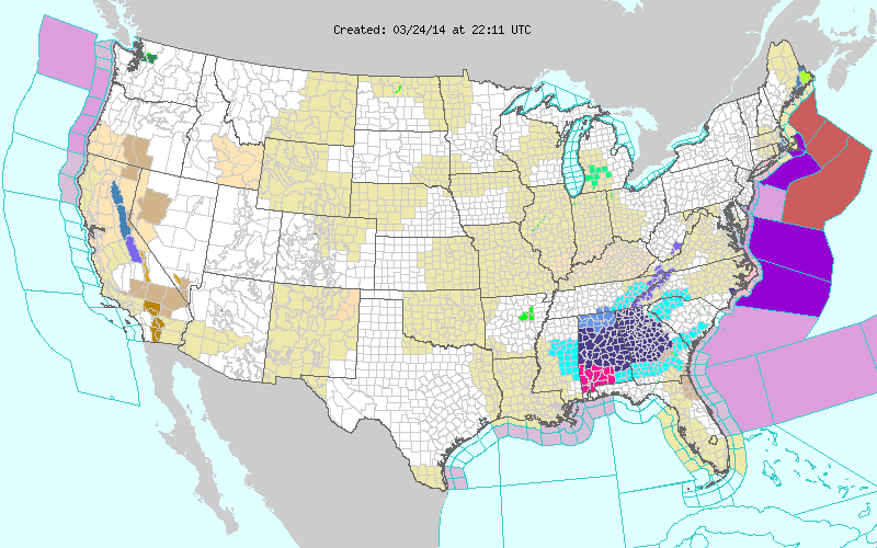
NOAA’s weather service touches the lives of every American. Every day, decisions are made based on NOAA weather information. From the mundane like, should I pack an umbrella today? to the most critical and potentially life-saving.
The one we'd like to pay attention to is the latter. Please, take a close look at their national map and then a much closer review of the northeastern coast of US.
Spring is put on hold for much of the eastern U.S as blizzard conditions possible with bombogenesis off the Northeast coast. What does this mean? If you live along the east coast of the United States, you may have heard a meteorologist say that a storm system or low pressure area is bombing out or that bombogenisis is about to occur. When a low pressure system or mid-latitude cyclone moves off of the East Coast of the United States during the colder months of the year, there is a tendency for many of them to intensify rapidly due to the warmer waters of the Gulf Stream and the positioning of the low between two very different air masses. The air mass to the storm's north and west is usually very cold and dry while the air mass to the storm's south and east is very warm and moist. The stormís rapid intensification is known as ìbombogenesisî or I've heard meteorologists say that the storm is bombing out. The heat given off by the ocean is like fuel for the storm. Barometric pressure can drop rapidly causing the winds to increase rapidly.
This is the reason noríeasters grow very strong and wreak havoc on the east coast. The warm moist air is extremely plentiful off the southeast coast. This energy feeds into the developing storm via the warm sector of the low. The warm air then rises as it encounters cooler air to the north. This rising motion causes condensation (clouds) to occur which then leads to precipitation. The condensation process actually creates heat (latent heat) and this process further adds fuel to the stormís energy. Upper level winds and conditions also add to the intensification process. If you look at a surface analysis map with the isobars, which are lines that connect equal barometric pressure, you will see that the lines are packed closely together in a storm that is bombing out. This indicates that the pressure gradient is steep and that the winds are strong. These storms sometimes produce hurricane force winds and they cover a large piece of real estate, extending farther than even the largest hurricanes.
Another Arctic high sliding down from western Canada and moving in over the central and eastern U.S. will keep temperatures well below normal across several locations east of the Rockies early this week. In addition to the cold...light snows will be possible with energy embedded in the flow aloft...which is now expected to swing through the Middle/Upper Mississippi Valley Monday evening and into the northern Mid-Atlantic region by Tuesday morning.
Showers and thunderstorms will continue to develop to the north of a frontal boundary stalled out over the northern Gulf of Mexico Monday evening...at the leading edge of an initial shot of cold air that plunged
through the central and eastern U.S. this past weekend. A surface low developing along the front will steadily track northeastward away from Florida's Atlantic coast Monday night into Tuesday...and precipitation across the southern tier should lift northward across the Southeast and Mid-Atlantic states. As the low continues its track up the Eastern Seaboard on Tuesday...the combination of the energy aloft swinging through the Mid-Atlantic region and a strong temperature gradient at the surface
will allow the storm to undergo rapid cyclogenesis...or bomb out.
By Wednesday morning...a 960 MB surface low is expected off the New England coast...which would be a 48 MB drop in 24 hours. The low should track far enough offshore to keep precipitation confined to the coastal regions. However; the combination of snow and the strong winds surrounding the deep cyclone could lead to blizzard conditions for some of the coastal areas of New England.
Widespread precipitation is expected with a Pacific front moving inland over the Western U.S. early this week. Initially...the majority of precipitation will fall as snow...but as temperatures and snow levels drop
behind the front...accumulating snows will be possible along the higher elevations of the Cascades...Sierra Nevada...and Central/Northern Rockies.
Shower and thunderstorm activity will be on the rise across Texas Tuesday night into Wednesday as a piece of southern stream energy lifts through aloft and moisture increases across the region from return flow out of the western Gulf.