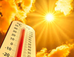
El Niño could amplify heat this summer, with forecasters warning of a strong chance the climate pattern will develop and persist through the end of the year.
The phenomenon, marked by unusually warm Pacific Ocean waters, can push global temperatures higher and influence weather patterns across the United States, including the Northeast.
The National Oceanic and Atmospheric Administration’s Climate Prediction Center says there is a 62% chance El Niño will form between June and August and continue into winter.
For New York City and the surrounding region, that typically means hotter-than-average conditions, periods of high humidity and the potential for heavier downpours.
A strong, or “super,” El Niño, which occurs when ocean temperatures rise significantly above average, can further boost global heat. Forecasters say there is roughly a one-in-four chance of such an event developing.
Even so, El Niño does not increase Atlantic hurricane activity. It tends to suppress storm formation by increasing wind shear over the basin.
Scientists say any El Niño-driven warmth would add to long-term climate trends, increasing the likelihood that this summer ranks among the hottest on record.