While Hurricane Lee forms in the Atlantic Ocean it is expected to rapidly intensify into an 'extremely dangerous' major storm on Friday.
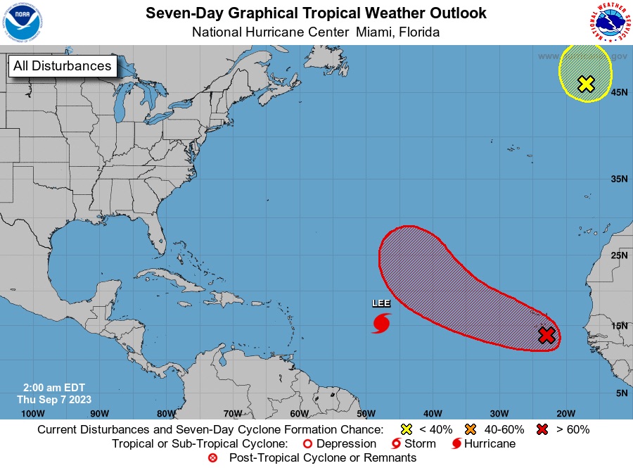
The National Hurricane Center is issuing advisories on Hurricane Lee, located over the central tropical Atlantic. 1. Eastern Tropical Atlantic (AL96): Showers and thunderstorms are showing signs of organization in association with a broad area of low pressure located over the eastern tropical Atlantic near the Cabo Verde Islands. Environmental conditions are expected to be generally conducive for additional development, and a tropical depression is likely to form during the next couple of days while the disturbance moves toward the west-northwest at about 15 mph. Heavy rains and gusty winds associated with this system are now occurring over the Cabo Verde Islands, and these conditions are expected to continue during the next several hours.
Meanwhile, a heatwave continues and severe thunderstorms threaten the East and South. Excessive heat warnings and heat advisories are in place for parts of the south-central U.S. on Thursday while a heat wave will continue in the mid-Atlantic and Northeast. Locally damaging wind gusts, marginal hail, and heavy rainfall will be possible across the Northeast into the mid-Atlantic and the Southeast on Thursday.