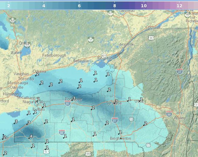
NY: 3 to 5 inches of snow on top of bitter cold attributed to frigid air streaming in from Canada courtesy of a dip in the polar vortex.
Three degrees this morning on City Island - A Slice of New York City Paradise. A high ribbon of air circles the north pole. The Northeast, especially from the Adirondacks into northern Maine, is taking the biggest hit from the cold air. Air temperatures -- not counting wind chill -- are expected to plunge to 30 below zero or colder. When you add in the wind, places like Whiteface Mountain could feel like 70 degrees below zero.
Dangerously cold wind chill temperatures will continue to impact the Northeast U.S. through Saturday evening along with blizzard conditions in northern Maine. High winds may bring power outages, tree and property damage, and difficult travel over the northern Rocky Mountain Front and adjacent High Plains through Saturday afternoon. Heavy snow will move into the Sierra of California.
A strong arctic front and associated gusty winds will produce bitter wind chills as cold as -50 or colder from the Upper Midwest to the Northeast. Chilly temperatures and gusty winds extend across the Mid-Atlantic. Lower-elevation rain and mountain snow from a weak system in the west will be followed by a stronger system this weekend with heavy mountain snow. Read
Meanwhile, after California was hit by a series of relentless storms from Dec. 27 to Jan. 16 it caused extreme flooding and extensive damage in most of the state, killing at least 22 people.
These types of storms, known as atmospheric rivers, are not new. In fact, they make an important contribution to the West Coast's water supply, providing, on average, 30% to 50% of its annual precipitation.