A complex winter storm will start today in the Midwest with heavy snow from the Upper Mississippi Valley to the Ohio Valley, including the Chicago metro area. On Sunday, the snow and wintry mix will spread into the Mid-Atlantic region before a potential Nor'easter intensifies and significantly impacts portions of the Mid-Atlantic, Northeast, and New England on Monday and Tuesday.
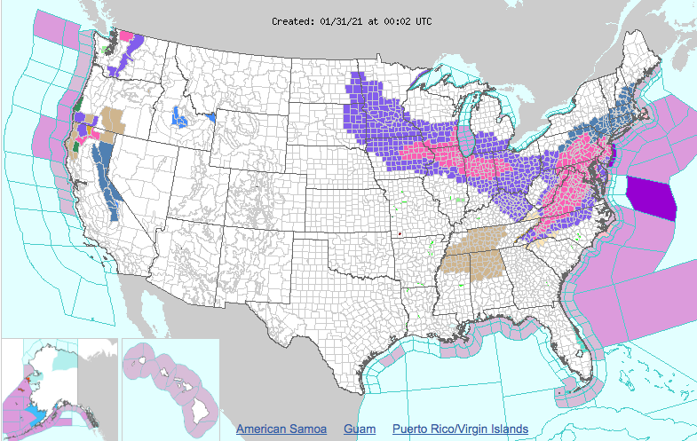
The winter storm is approaching 20 states and it promises to be a humdinger. Wintery weather advisories, watches, and warnings and more span 20 states, according to the National Weather Service's Weather Prediction Center, which has said 8 or more inches of snow is likely in regions of Maryland, Pennsylvania, New Jersey, New York, Massachusetts, and other Eastern states.
Once the parent storm system marches east into upper Ohio Valley Sunday night, a developing frontal wave over eastern North Carolina will become the focus for a newly developing area of low-pressure Sunday night. Snowfall over the northern Mid-Atlantic Sunday night may switch over to a wintry mix for some, but by Monday the new coastal low quickly strengthens off the DelMarVa Peninsula coast on Monday, forcing bands of heavy snow to form from the central Appalachians to the Northeast's immediate I-95 corridor. Significant snowfall and travel disruptions are anticipated in these areas with over a foot of snow likely in the hardest-hit areas of the Northeast on Monday. The coastal storm will stall off the Northeast coast as the upper level low to the west and blocking the ridge of high pressure to the north slow its progress. Snowfall is likely to persist over the Northeast Monday night and into the day on Tuesday. In addition to the snowfall, gusty winds may lead to near whiteout conditions, and battering waves along the Northeast coast could foster areas of coastal flooding and beach erosion. Residents in these regions should continue to monitor the forecast closely for the most up-to-date information.
