A History of Rodman's Neck
Written and Researched by P.O. Kevin J. Flynn
The following is a history of Rodman's Neck and the surrounding area from the early 1600's to the present day. As you read the accounts of what took place on the site we now know as the Outdoor Range and Pelham Bay Park, you will get a sense of the hardships and the dedication the men and women went through to preserve their rights for freedom and religion. The sound of gunfire is no stranger to Rodman's Neck, home of the New York City Police Department's Outdoor Range. The ancient moss, which covers the range and surrounding area, has resounded to those sounds many times in the past. The conflicts fought here have played a decisive role in the history of the city and of our nation.
"This is the place, stand still my steed. Let me review the scene And summon from the shadowy past, The forms that once have been."
— Henry Wadsworth Longfellow
The original inhabitants of Rodman's Neck were the Siwanoy Indians. As part of the great Mohegan Nation, this tribe spent the warmer months of the year along the northern shore of Long Island Sound from the Bronx River to the Norwalk River, in what is now Connecticut. They wintered in the vicinity of Hell Gate on the East River. Their mode of transportation was the canoe. The Siwanoy Indians fished and clammed in the bountiful waters that surrounded Rodman's Neck. In those early times, the Neck was covered with stands of giant oak trees, and game animals were plentiful in the nearby forest.
In 1640, the Dutch West Indian Company, which settled the colony of New Amsterdam (with Peter Minuet's famed purchase of Manhattan Island in 1626), entered into negotiations with the Siwanoy Indians. The negotiations ended with the purchase of a parcel of land located between the Bronx and Norwalk Rivers. However, the Dutch failed to live up to their end of the agreement. It seems that Wilhelm Kieft, who succeeded Peter Minuet as governor, aroused the hostility of the Siwanoy and the other Indian tribes living around New Amsterdam by his unfair trading practices and inhumane treatment. As a result of this insensitivity, the Indians killed many of the early Dutch settlers.
The First White Settlers
The first white settlers of Rodman's Neck moved into this troubled atmosphere in the year 1642. Anne Hutchinson, with her family and a small group of friends, started a settlement on the east side of a meandering stream, which bears her name: The Hutchinson River. The river marks the west boundary of what is now known as Rodman's Neck. A bridge crosses the river on the shore road leading from Pelham Bay Station. In those days, Anne Hutchinson's Dutch neighbors called the area around her settlement, "Anne Hoecke," or "Ann's Neck."
Anne Hutchinson was born in 1591 to Francis Marbury and Bridget Dryden in Alford, Lincolnshire, England. She married William Hutchinson, a merchant, on the 9th of August 1612. She and her husband came to America in 1634 with the Reverend John Lothrop's group on the ship "Griffin" and settled in Boston. In the Massachusetts Bay Colony, she and her husband raised a large family. Sometime after arriving in the Bay Colony, Anne ran afoul of the Puritan leaders of the Colony. She opposed the theocratic beliefs that these rulers held, and they put her on trial. Ann was found guilty and was banished from the colony. Banished from Boston, Anne Hutchinson, with her husband, children, and 60 followers, settled in the land of Narragansett's, from whose chief, Miantonomah, they purchased the island of Aquidneck (Peaceable Island), now part of Rhode Island. In March 1638, they founded the town of Pocasset, the Indian name for that locality; the name "Portsmouth" was given to the settlement in 1639. Here, they established the colony's first civil government.
After Williams died in 1642, Anne took her children, except for five of the eldest, to the Dutch Colony in New Amsterdam. Unfortunately, this haven from oppression was doomed by the hostilities that existed between the Dutch and the local Indians. During 1643, over 1500 braves went "on the warpath" and raided settlements from northern Manhattan to Connecticut. During some of these raids, the Hutchinson family sought refuge in the crevice of a large glacial rock near their camp. This "split rock" can still be seen in the northwest part of Pelham Bay Park, just where the Hutchinson Parkway intersects with I–95. The line of vision of one looking through the split towards Hutchinson River at the foot of the hill will very nearly cross the site of the house. Sadly, Anne Hutchinson's tactics of hiding during Indian attacks did not always work. Anne, along with 5 of her youngest children and most of her followers, were massacred during one of these raids. The Indians struck the Hutchinson settlement in the early morning hours. They drove all the cattle into the barn and set it on fire. Two of the settlers escaped the carnage and were picked up by a sloop passing in Long Island Sound. The burning barn had attracted the ship. In the ensuing battle between the Indians and sailors, two of the ship's crew were killed. Only one young daughter, who was present, Susanna, was taken captive and survived.
The Story of Anne's Daughter
The Indian Chief who led the raid against the settlement captured Susanna. The Indian chief called Wampany is supposed to have assumed the name of his chief victim after the raid on the Hutchinson settlement. He was always thereafter known by the name of "Anne Hoecke." The Indians held this daughter for about 4 years until the Dutch, as part of a peace agreement, arranged her release. One of the terms of that accord was that the child be returned to their mother's friends in New England. It is said that the girl refused to leave the Siwanoy Indians. Since she was very young at the time of her capture and could no longer speak or understand English, she may have had no desire to leave the only people she really knew. Wampany "Anne Hoecke," who by now had become a great chief, supposedly married her. Their daughter, also called Anne Hoecke, married Thomas Pell, son of the second Lord of Pell Manor. It is known that Thomas Pell married an Indian Princess and that they lived in Fairfield, Connecticut. The couple had a total of twelve children.
Anne's Neck Becomes Pell's Point
Thomas Pell, the first Lord of Pell Manor, was an English gentleman who fled to the New World after the downfall of King Charles I. Pell landed in the area of Fairfield, Connecticut, and, in 1654, obtained a grant of land from the Indians for 16,000 acres lying east of the Hutchinson River. This land included all of what is now known as Rodman's Neck, Pelham Manor, New Rochelle, and City Island. It is interesting to note that one of the marks of an Indian chief who signed the deed was "AH" with the legend "Anne Hoecke" written next to the mark. The deed itself is on exhibition in the Bartow-Pell Mansion Museum, located about a quarter of a mile from the Outdoor Range on Shore Road. The museum is just across from the Split Rock and Pell Golf Course Clubhouse.
In addition to Thomas Pell, other English adventurers had moved down both shores of Long Island Sound from the New England area. These Englishmen sought their fortunes by laying claims to land from Virginia to New France (Canada). These claims were in dispute with the Dutch possessions in New Netherlands (North America), especially with the New Amsterdam colony, based on the discoveries of the explorer Henry Hudson, who sailed under the Dutch flag.
A recent investigation has revealed that the Dutch issued a warrant on November 5, 1654. It directed attorney general Cornelius Tienhoven of New Netherlands to evict Thomas Pell and the others from the land known as Vreedslandt, meaning "land of freedom" or "land of peace" in English. Reportedly, the men who delivered the warrant were captured and beaten before being sent back to New Amsterdam. Pell and his followers continued to keep "watch and ward" against both the Dutch and the Indians for the next ten years. In 1664, Dutch fortunes in the New World began to wane as Peter Styvesant, then governor of New Amsterdam, surrendered the city to the English without a single shot being fired.
By 1664, King Charles II, son of the dethroned and beheaded Charles I, assumed the throne in England after the death of Lord Oliver Cromwell, the Lord Protector. The new king wasted no time in giving the matter of disputed lands in the New World his personal attention. He granted these lands to his brother, the Duke of York. An expedition was fitted, consisting of about 600 men, two frigates, and a fly-boat. Colonel Richard Nicolls, later to become the first English governor of New York, was in command. By August 25, 1664, the small fleet was anchored in New Amsterdam (New York) harbor.
The government of New Amsterdam was structured as a commercial enterprise known as the Dutch West Indian Company. A governor appointed by the Dutch government ruled it. Businessmen in Holland ran the colony as a profit-making venture. However, many of the citizens of the colony were persons of other nationalities who had settled there for religious and political freedom. The government did not have the best interests of these people at heart. Colonel Nicolls used this information to his advantage. He sent an order of surrender to the city. Nicolls stated in the document that the person and property of the people were secure if the garrison surrendered to the English. The magistrates of the City, after a council meeting, advised Peter Styvesant that they would neither advise him nor support him. The governor and his garrison surrendered without a fight. New Amsterdam was then renamed New York in honor of the Duke of York.
The taking of New York City by the English brought about an upturn in the fortunes of Thomas Pell. The Duke of York granted Pell a King's charter for all the land he claimed to have purchased from the Indians. Unfortunately, Pell did not live to fully enjoy the fruits of his hard-earned labors. He died of "Consumption" about 1669. His lands were willed to a nephew named John Pell, the son of a minister living in England. Young Pell and his descendants, through shrewd management of the property, amassed a great fortune. They ruled the land under the King's Charter much as English landlords did in the mother country. The name Pell's Point was changed to Rodman's Neck after a Pell daughter, named Sara, married Jacob Rodman. They built a house and lived on the point.
The Battle of Pell's Point
In the fall of 1776, the small force of volunteers who were fighting under General George Washington found themselves holding a position on the heights in northern Manhattan. They had suffered a series of defeats in and around New York City. This group of badly trained and equipped Yankee soldiers now held a position against General Sir William Howe's crack troops, including the famous Black Watch and Hessian Mercenaries. Unfortunately, the Yankees could not hold out much longer, and their backs were to the Harlem and Hudson Rivers. Also, winter was coming soon, and a complete defeat would bring a speedy end to their "War of Rebellion." General Washington and his men had to retreat from what would later be known as the Battle of Harlem Heights, and march northward to White Plains to re-group and get supplies.
General William Howe, rather than make a frontal assault up the Heights, decided to flank Washington's only means of escape, a wooden bridge that spanned the Harlem River to the mainland. This bridge and the section of mainland that surrounded it were known as Kingsbridge. Howe had 6,000 "hand-picked troops" put aboard ships and they sailed up the East River to Throggs Neck in the northeast Bronx. There was a road running from Thoggs Neck to the bridge at Kingsbridge. It seems that at this point, General Howe either made a great tactical error, or else he had faulty intelligence. The General believed that Thoggs Neck was a peninsula; however, it is an island cut off from the mainland by Westchester Creek.
As General Howe landed his troops, the American forces, including a regiment of Pennsylvania riflemen, tore up the mainland end of the bridge that crossed Westchester Creek at a place now called Westchester Square. Using a mill located nearby as cover, they began sniping at the British and Hessian forces as they tried to ford the creek. The Americans were successful in preventing Howe's troops from crossing. He had to retreat to the nearest high ground, where his advance was held up for several days. However, early on the morning of the fifth day, October 18, 1776, General Howe again attempted an amphibious flanking movement. With three ships and 200 boats, he embarked with 4,000 men from Thoggs Neck across the three miles to Eastchester Bay to Pell's Point. This location was the nearest spot on the mainland from where he could now reach Kingsbridge and trap General Washington and his retreating forces.
Encamped in the town square of the village of Eastchester, about three miles from Pell's Point, was a brigade of Massachusetts Riflemen. This "skeleton brigade" consisted of four regiments, totaling about 843 men. Colonel John Glover was in temporary command in the absence of the unit's commanding officer, General James Clinton. Glover and his regiments were called Marblehead's and were composed of "sturdy fishermen and sailors." These men were untrained volunteers who had earlier in the year played an important role in the evacuation of Washington's troops from Long Island, which is now Brooklyn Heights. Later, this same winter, they would attain immortality for their raid on Hessian troops in the Battle of Trenton as they crossed the Delaware River on the early morning after Christmas 1776.
Nevertheless, on this October morning, Colonel Glover mounted a height near his encampment and, looking through his telescopic glass, observed General Howe's landing force approaching Pell's Point. Glover, untried in battle, felt the weight of command heavy as he viewed that sight. This fact is known from a communication sent by Glover to General Lee, an aide of Washington, asking Lee to come to Eastchester at once. Glover was looking for someone to relieve him of the responsibility of command, or at least to concur in his tactics. General Lee never responded to the message. Left to his own resources on that day, Glover proved himself to be a master tactician. He deployed his limited resources to their greatest advantage. Outnumbered on the battlefield nearly seven-to-one, he used his troops and their ability of accurate (though slow) marksmanship to the greatest possible advantage.
To fully appreciate the disadvantage that Colonel Glover and his men fought under during that autumn morning, one must understand the difference between the Hessian and British weaponry and how the American Volunteers used their arms. The British and the Hessian regulars were well-trained soldiers who could load and fire three volleys from their Tower Muskets in about 45 seconds. The Americans, on the other hand, could only fire one round from their rifled "squirrel guns" in the same length of time. Their rifle was slow to load. Powder had to be poured into the barrel, and then the lead ball had to be rammed into the barrel by a rod. It was a slow and tedious operation. However, the squirrel gun was an extremely accurate weapon. On the other hand, the British and Hessian military musket fired a loose-fitting lead ball, which could be readily dropped into the barrel after pouring in the powder. It was not as accurate as the Yankee rifle, but it was of great value in the military tactics used during that era. Contrary to generally held belief, at this point in the Revolutionary War, American forces did not customarily fight from behind trees and fences. They formed solid lines of battle just as the British did. Battles fought in this manner required firepower and the ability to use the bayonet charge. The British and Hessians were experts in this phase of warfare. The Americans did not even have a bayonet lug on the end of their rifle; consequently, they did not have bayonets. This fact, coupled with their weapons' slow rate of fire, caused the Americans to be routed on several occasions when faced with the bayonet charge. These were some of the conditions that Colonel Glover pondered on that fateful morning.
Upon sighting the enemy, Glover mustered his troops in the village square. He left his own regiment, the Massachusetts, in reserve. Then he marched to Pell's Point with the remaining three regiments: Read's Thirteenth, Shepard's Third, and Baldwin's Twenty-sixth. In all he had 650 men and three artillery field pieces. Upon arriving at Pell's Point, Colonel Glover sent a captain with thirty men forward to meet the Hessians who were in the vanguard of the land force. The remainder of Glover's men was placed behind three stonewalls, located about one mile from Pell's Point. Two of the walls ran along the side of a road leading back from Pell's Point. The other wall was in a field beyond (the remains of these walls can be seen today in the northern portion of Split Rock Golf Course). The captain and thirty men who had gone to Pell's Point engaged the Hessian enemy in a brief firefight. When two of the Americans were killed and another two wounded, the others began to retreat. The Hessians gave chase as the fleeing men moved back towards the first of the three walls. When the Americans reached this wall, they jumped over and continued to run for the 2nd wall. As the Hessians gave chase, they did not realize that over 200 Americans lay concealed behind that first wall. As the Hessians reached the wall, the Americans opened fire. After a brief exchange, the Hessians fell back to await the arrival of their full landing force.
A bombardment from guns aboard the British ships did not affect the Yankees concealed behind the stonewalls. The initial engagement had caused heavy losses to the British. It was afternoon before the battle resumed, and now General Howe was in command. When the British attacked again, they suffered additional losses. They crossed the road and moved beyond the second wall, making for the third. Again, the enemy was taken by complete surprise when American rifles, from behind the seemingly undefended second wall, opened fire and volleyed into their ranks.
The battle lasted well into the afternoon until Colonel Glover withdrew his troops and marched back to Eastchester Village Square. The British eventually took the ground, but the Yanks had taken the day. They had held long enough for General Washington to march his troops from Manhattan fifteen miles to White Plains, where he would re-group his Continental Army. After the Battle of Pell's Point, the British were completely disorganized. Many of the Hessian soldiers were either killed or wounded, and several others deserted. Because of the confusion, General Howe was unable to reach White Plains for three days. During the battle, American forces had lost about 30 men. The British claimed similar losses; however, American intelligence reports of the day list the enemy figures for casualties at over 1200. Admittedly, this figure is probably an exaggeration, but it is accurate to say that General Howe's troops suffered far greater losses than did the Americans. Probably, about two to three hundred of his men were either killed or wounded during that engagement. It would take seven long years before General George Washington and his victorious Continental Army returned to New York City. If Colonel Glover and his men had not fought so valiantly at Pell's Point, one may wonder if our Republic would have existed at all.
A Saint Comes to Pell's Point
From the Revolutionary War era until the year 1888, when the City of New York purchased Pell's Point for part of what is now Pelham Bay Park, the land was again returned to its farmer-merchant occupants. These people were the Pells, their relatives and friends who had bought the estates on the large Pell holdings. One of the families who held a piece of land just north of Pell's Point was the Bayleys. A biographer of one of the Bayley daughters, Elizabeth, tells how the family's favorite picnic spot was a grassy meadow that skirted the Hutchinson River. It is the same place where Anne Hutchinson and her followers had been murdered. The biographer also says that it was here that young Elizabeth Bayley learned about the beauty of nature and of her special closeness to God. This child would later become a very famous woman: Elizabeth Bayley-Seton, Mother Seton, the first American Saint.
She was a girl of aristocratic birth who enjoyed all the benefits of the country squire's life. She was related to the Pells, the Roosevelts, the La Fages, and other famous American families residing in the area. Nevertheless, later in her life, she would go to New York City and perform great works of charity for the poor and underprivileged. Mother Seton and her followers founded many charitable institutions, including the New York Foundling Home, Saint Vincent's Hospital, Saint Patrick's Orphanage, a hospital in Kingsbridge, and hundreds of schools and other charitable institutions throughout the United States.
The Navy at Pell's Point
In 1917, the United States found itself engaged in the "war to end all wars," World War I. At the time, the German "U-Boat" was the scourge of the Atlantic Ocean. The American Navy was faced with a large expansion program. Part of training these new sailors and officers was conducted at Pelham Bay Naval Training Center, located on the site of the present-day Outdoor Range. The base was built in record time. The barracks and facilities for five thousand men were constructed in just two weeks. By war's end, the camp had facilities for sixteen thousand men. More officers were trained in the Officers Material School at the Pelham Bay Naval Center during 1917 and 1918 than had been trained in the entire Navy before the war. There were six full regiments of enlisted personnel regularly in training. Sadly, many of these men paid with their lives, not on the glorious field of battle, but in the fever-ridden sick bays during the influenza epidemic of 1918. The Pelham Bay Naval Training Center was one of the first and hardest hit in the metropolitan area. The base was on quarantine month after month. Many people blamed the lack of sanitary conditions at the base for the spread of the epidemic to New York City. This was untrue. The epidemic was worldwide, and fear of the dreaded disease caused panic in virtually everyone. The base was finally closed early in 1919. When the war ended, Rodman's Neck again became a quiet park.
Camp Mulrooney
The New York City Police Department first came to Rodman's Neck in the 1930's. Camp Mulrooney was established as a summer home for the New York City Police Academy. Its headquarters was the large drill hall that had been left behind by the Navy on the site, which is now the circle leading to City Island. No rookie who did his time at Camp Mulrooney will ever forget the tough bosses who ruled the place: Inspector John J. Noonan, Captain John Murray, Lt. Julius Brilla, Sgts. Izadore Cantor and Howie Briggs, whose names were a legend to a whole generation of New York City Policemen. In the 1930's, before New York was covered by superhighways and the Whitestone and Throggs Neck Bridges were built, Rodman's Neck was a very difficult place to reach. By 1936, the department finally decided to relinquish the camp when Orchard Beach was built, and Pelham Bay Park was undergoing extensive development.
Rainbow — The America's Cup
The flagpole that now stands between "CHARLIE" range and "BOY" range was originally the mast from the America's Cup winner, the "Rainbow." No one could ever forget the sight of the rookies from Camp Mulrooney, about one hundred strong, as they marched to City Island to carry back the huge mast from the racing yacht. Starling Burgess designed the Rainbow in 1934 for the New York Yacht Club. The Rainbow was later sold to Cornelius Vanderbilt, who raced it for some time before it was decommissioned and the mast taken to the Outdoor Range, where it now stands. As a gesture of good luck, the rookies tossed coins from their pockets into the concrete base that was being poured to hold the mast.
Atomic Age Comes to Rodman's Neck
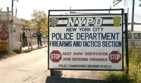
Some restless spirit within Rodman's Neck wouldn't permit it to remain a peaceful park. Once again, in the late 1940's, it was called to the service of the country. With the arrival of the atomic age at the close of the Second World War and the introduction of the Cold War conflict between East and West, the United States could no longer count on the vast distances separating it from its enemies as a primary means of protection. Anti-Aircraft bases were established across the country to protect the large cities from attacks. Rodman's Neck, centrally located within the Greater New York area, was chosen as a radar fire control center by the Army for the Nike Rockets in defense of New York City. The installation of the fire control center consisted of five prefabricated barracks, a mess hall, a garage, and sanitary facilities, as well as the radar equipment installations. The base was used until the mid 1950's, when the introduction of Intercontinental Ballistic Missiles made the use of such localized defense positions obsolete. The Army abandoned the installation, and control was returned to the Department of Parks. The buildings are still here today and are in daily use by the Firearms and Tactics Personnel.
Echoes Across the Park
The casual stroller who wanders over the grounds of Rodman's Neck can almost visualize the scenes of history before him or her. For the Neck, one of the City's last unspoiled locations, has undergone little change since Anne Hutchinson first moored her sloop in Eastchester Bay. If you listen carefully, you can almost hear in the invisible distance the echoes of the past three hundred years: pilgrims' muskets buying in blood the liberty we enjoy today; the volley of Rebels and Redcoats saluting with shot the birth of a new nation; the trampling feet of thousands of Yankee riflemen and Hessian Grenadiers. The 1917 U.S. Navy Blue jackets, New York's Finest vintage 1930's, and the G.I.'s of the 1940's and 1950's with their missiles waiting for targets that thankfully never came.
The mind does play strange tricks in the peaceful woods and meadows of Pelham Bay Park. But wait, the imagination has not removed us from reality. Those sounds are real. Rodman's Neck is now the site of one of the largest pistol ranges in the United States of America. It is home once again to the New York City Police Department Academy Outdoor Range. In the late 1950's, there was, in the New York City Police Department, an important need for improving the training of the "Force." Not unlike the training given to British Redcoats, the basic firearms training of the department consisted of single-action, cock the weapon, and firing from a standing position. This type of training was fine for attaining a high score in target shooting, but was unrealistic for improving the hit potential of New York City Police Officers during a gunfight. What was needed? Training that would enable the police officer to emulate his Yankee forbearers by using instinct and whatever protective cover was available at the time of a gunfight. This type of shooting strategy has long been a part of the American tradition. Our early pioneers copied it from the Native Americans, and it moved west with our expanding nation and helped bring law and order to our people.
To carry out the training program needed to give police officers proficiency in combat situations, the New York City Police Department decided that a large range would have to be constructed — one that could accommodate more than 200 officers a day, and permit the firing of large quantities of ammunition. Rodman's Neck, located in the northeast section of the Bronx, seemed to offer an ideal site. The Neck was surrounded by water on three sides. The remaining area was fenced in from Pelham Bay Park. Also, the facility still had some buildings left behind from the Army. Finally, the location was convenient with good highways from all parts of the city.
In October of 1958, an agreement was reached among the Police Department, the Parks Department, and the United States Army. Under this agreement, the Rodman's Neck anti-aircraft site was leased to the Police Department with ownership of the land retained by the Parks Department; this has since changed and ownership is now in the hands of the Police Department. A large earthen mound was erected to act as a bullet backstop. Engineers from the New York City Sanitation Department excavated 1,000,000 cubic yards of earth from a pit dug at the rear of the mound. When completed, the mound was 180 ft wide, 800 ft long, and 35 ft high. A crew of police officers was assigned to refurbish the existing buildings, to improve the lighting and heating, and to overhaul the sanitation facilities. Inmates from the Department of Corrections facility on Harts Island were of great assistance in the construction and early maintenance of the Range. Selected inmates were assigned for general maintenance as well as the construction of new facilities. The Range was then opened for training police officers in the art of revolver and tactical proficiency. In the early 1960's the Range was put in the hands of Lt. Frank Magee. In those early years police officers were trained in bull's-eye shooting, but as the years passed the role of the Outdoor Range grew and the department took on the combat shooting training, which is still taught today. The police officers today have moved to the semi-auto pistols, which each new recruit class is required to have. Each recruit goes through 8 days of firearms and tactics training. The Firearms and Tactics Section is always improving and updating their training to meet the needs of the police officers on the street, as well as those in Emergency Service, OCCB, Harbor, Aviation, and the various other units as well.