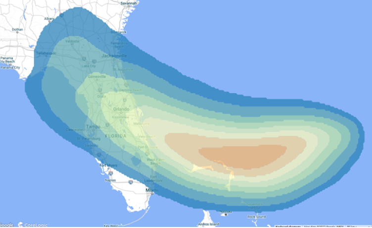
There are three things to know about Nicole: As this fast-moving hurricane approaches the people living in the state of Florida.
Nicole makes landfall as a Category 1 hurricane, bringing heavy rainfall with possible flooding across Florida and parts of Georgia and South Carolina.
https://www.corelogic.com/intelligence/blogs/hazard-hq/three-things-to-…
Nicole is expected to produce a variety of hazards across Florida into the Southeast through Thursday including, a dangerous storm surge, hurricane and tropical storm conditions, heavy rain with flooding and severe storms with tornadoes. Meanwhile, a powerful storm system will deliver a taste of winter to the Upper Midwest with snow, ice, blizzard conditions, high winds, rain and severe storms.
https://www.wpc.ncep.noaa.gov/discussions/hpcdiscussions.php?disc=pmdspd
NATIONAL WEATHER CENTER
Meanwhile, as Nicole reminds us we are still in Hurricane Season, it will feel more like the winter season in the northern central U.S. as a deepening low pressure system brings winter storm conditions to the region. Heavy snow, as well as sleet and freezing rain, will impact the northern High Plains, Great Plains, and Upper Mississippi Valley today into Friday. Heavy snowfall rates of 1-2"/hr are possible today from the Dakotas eastward into northwestern Minnesota. Gusty winds combined with heavy snow could produce blizzard conditions at times. Total snowfall will likely exceed 12" in some locations.
Blizzard Warnings, Ice Storm Warnings, and Winter Storm Warnings are in effect for the Dakotas, northwestern Minnesota, and eastern Montana. Ahead of the low pressure system, isolated severe thunderstorms will be possible across portions of the Upper Midwest today where the Storm Prediction Center has issued a Marginal Risk of severe thunderstorms (level 1/5). Damaging winds and a brief tornado will be possible.
Remember, knowledge, wisdom and power is the ability to decide when to evacuate.