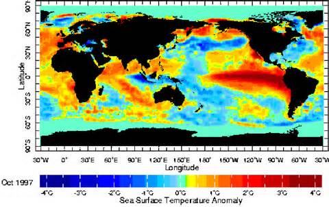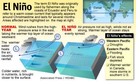

Due to the weak strength of the El Niño, widespread or significant global weather pattern impacts are not anticipated. However, certain impacts often associated with El Niño may appear this spring in parts of the Northern Hemisphere, such as wetter-than-normal conditions along the U.S. Gulf Coast.
The consensus forecast calls for an approximately 50-60% chance that El Niño conditions will continue through Spring. In the ocean-atmosphere coupling indicative of El Niño, warmer waters lead to atmospheric changes, and those atmospheric changes in turn help maintain the warmer water. So, it’s possible that even the weak coupling we’re seeing now will support the continuation of the positive SST anomalies. As I mentioned above, the recent westerly wind anomalies and the down-welling Kelvin wave will also help to keep the SSTs above average for the next few months.
Dynamical climate models are mostly forecasting a slow increase in the Niño3.4-region SST anomalies throughout 2015. Springtime is a difficult time of year for forecasting, as models traditionally have some difficulty seeing beyond the so-called “spring barrier,” and so the CPC/IRI consensus forecast probabilities decrease somewhat going into the summer, as forecast confidence decreases. That said, probabilities remain at or above 50% that El Niño conditions will continue through the fall.
After twelve months of El Niño Watches, we are issuing an El Niño Advisory. However, what it really represents is an incremental crossing of the borderline. If we follow the “Is it El Niño Conditions” flowchart, the warmer SST conditions, our anticipation that they will continue for the next several seasons, and signs of weak atmospheric coupling over the past month, mean we arrive at “yes!” From an impacts perspective, this is not particularly momentous, as El Niño impacts are weak in the spring and summer. Still, after months of hovering under the threshold, we can now say that El Nino conditions have arrived.