DON vs RON
Images

From the Gipper to the Groper - Forget about it, which name is more popular, Ronald or Donald?
From the Gipper to the Groper - Forget about it, which name is more popular, Ronald or Donald?

No court ruling yet — it's still inside the FCC. This hasn't reached a federal judge. Right now it's playing out through the FCC's own administrative process:
ABC filed its "reply comments" on July 7 defending "The View" as a bona fide news program under a 2002 FCC precedent, arguing the government can't "sit in an editor's chair."
More than 77,000 public comments were submitted, with an undeniable majority backing "The View" and free speech, according to ABC's filing.
ABC is also arguing the FCC's selective focus — going after daytime/late-night TV while leaving talk radio alone — isn't evenhanded regulation.
The FCC pushed back through a spokesperson, saying ABC should focus on compliance rather than "misleading the public."
There's a separate wrinkle worth watching: the sole Democratic FCC commissioner, Anna Gomez, has alleged the agency offered other ABC affiliates amnesty for late equal-time disclosures but withheld that same offer from the Disney-owned station now under investigation — which, if it holds up, would be a much sharper claim of selective/unequal treatment than the broader "bias" argument.
Separately, ABC's local station license renewals are also under review, with public opposition to those due July 29 and replies due in August.
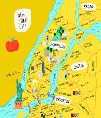
New York City is America’s tossed salad and melting pot. NYC has separate and distinct cultural "zones" defined by deep ethnic roots, immigration waves, and local geography. Every borough and region feels like a completely different country. NYC’s map highlights 30 immigrant neighborhoods across the five boroughs, including Chinatown, Koreatown, Little Poland, Little Guyana, Little Haiti, Little Palestine, Little Yemen, Little Ukraine, Little Odessa, and many more.
But many New Yorkers quickly noticed that some of the city’s most historic immigrant communities — including Little Italy — are missing. Italian-American leaders, along with others, have criticized the map, arguing it overlooks neighborhoods that helped shape New York’s identity. City Hall says the map focuses on current neighborhoods with substantial foreign-born populations rather than documenting every historic immigrant community, and officials have said additional neighborhoods may be added in the future.
New York City is a massive puzzle of distinct NYC ethnic enclaves. Neighborhoods act as cultural zones where different groups share their food, art, and traditions. This makes it easy to travel around the world just by taking a short subway ride
Staying cool during the hot summer days and nights.

Is E Jean Carroll the news Six Million Dollsr a woman? This comparison is about money, here's the context:
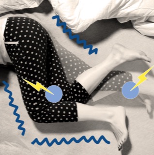
Are you tired, prioritize sleep snd end up exhausted despite my best efforts. I never feel well rested.
For millions of people, poor sleep has become so normalized that they no longer recognize it as a potential medical issue. Feeling tired all the time gets blamed on stress. Freight train snoring becomes a family joke at the dinner table. Trying not to doze off during that weekly meeting means your job is boring.
What readers are saying
How many ways can the "Bully Pulpit" be abused?
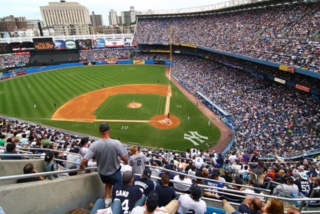
New York, NY, a City so nice they named it twice. And in sports it has not ever done anything small, least of all sports.
The Yankees alone have won 27 World Series, more championships than any team in any American sport, while the Mets chase a third title of their own.

The syndicated series, as shown in the United States, is a potpourri of segments from previously aired versions of the show. Prior to a 1994 remaster, each episode included a "teaser" at the top of the show, asking viewers to stay tuned for a clip from "today's four-part story" (This originated from a 1969-1973 NBC Saturday morning rerun version of the show

The World Cup always takes me back to one unforgettable sports assignment from my days as a young journalist and cub reporter.
Because I spoke several languages and Pelé did not speak English, I was chosen to interview the man who had become the face of the world's game. Armed with nothing more than a press credential, youthful determination and a reporter's curiosity, I traveled to a stadium in Miami hoping for a few moments with a living legend.